
Project insights that matter, digital twins made simple.
Professional Digital Twins Built by Architects & Industry Experts
2.1M+
Square feet
captured this year
$3M+
Project
cost savings
Discover our services

Design & Construction
Virtual Site Visits
Architectural Site Surveys
Floor Plans & BIM for Existing Conditions

Real Estate
Immersive 360 Virtual Tours
Schematic Floor Plans & Property Reports
Media Available for Listings

Facilities Management
Track Assets without need for BIM
High Quality 360°, Measurable Photos
View on Phone, Tablet or Computer
Get accurate documentation for your project
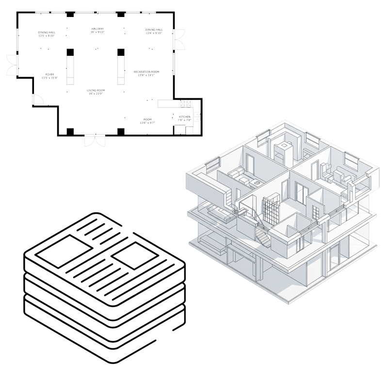
✓ 2D Floor Plans, Reflected Ceiling Plans, Roof Plans
✓ 3D Building Information Models
✓ Accurate measurements
✓ Locate structure, MEP and other vital building systems
Walk through your project virtually
✓ Visit your site 24/7 365 with no need to travel
✓ Highlight areas and send them virtually to colleagues or clients
✓ Smoother and faster decision making with visual and measurable content
✓ View on mobile, tablet or desktop
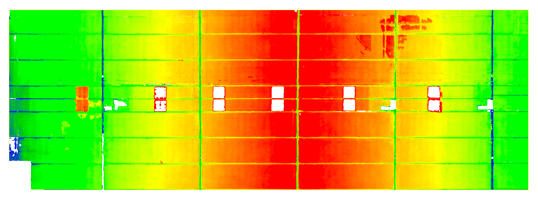
Gain insights through advanced analytics
✓ Pinpoint floor flatness and roof slope
✓ Comprehensive conditions insights
✓ Real-time progress verification
✓ As-designed vs. as-built precision
✓ Side-by-side comparisons
Our Clients

FAQ’S
-
A Digital Twin is an accurate, digital representation of a physical space — whether it’s a simple visual walkthrough or a fully integrated BIM model for facilities management. Our goal is to help you find the right approach for your project, delivering maximum value with minimal disruption.
-
A site visit typically takes anywhere from a couple of hours to a few days, depending on the size and complexity of the project. Scans can be scheduled after hours or on weekends to minimize disruption. Final deliverables are usually available within a few business days.
-
We use industry-leading tools tailored to each project’s unique conditions, goals, and deliverables. Depending on the environment, this may include 3D laser scanning, LiDAR, photogrammetry, 360° imaging, mobile mapping, drone-based aerial mapping, and AI-powered software.
-
Measurable and accurate 2D drawings and 3D BIM
Interactive 3D virtual tours
High quality photographs
Custom project dashboard
Project analytics (Floor and roof flatness, finish floor heights, etc.)
Asset-tagged Digital Twins
Everything is easy to access and quick to share